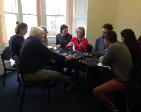
In the Sustainable Places Research Institute – the place where I am based, some Friday afternoons are dedicated to one-hour seminars where academics can give short presentations of their work. These sessions are open for anyone to attend and the audience is generally made of approximately 20-25 persons. The presenter is free to decide on the format she/he wants and people often choose to talk about their projects for the first part and then have a Q&A session.
As an early stage researcher, the thought of hosting such a session on my own was really unnerving. However, having finished my research design in December, I felt like I was ready to talk about it and receive some feedback from people who had not heard my ideas before. At the same time, I knew it could be a good setting to test one of the research methods I was planning to use for my fieldwork.
This is why I decided that the format of my seminar should include a 15-20 minute presentation of my theoretical framework and the methodological choices, followed by a brief discussion and then a participatory mapping exercise. Participatory mapping is a qualitative research method that asks participants to collectively create a map, depending on the subject proposed by the researcher/facilitator. The discussions sparked by this exercise are just as important (or maybe even more) than the final outcome so the researcher should be very attentive to the different topics which might come up. Another advantage is that even shy and less extrovert persons find it easier to get involved. Besides, participants might get the change to exchange ideas and learn from one another.[1]
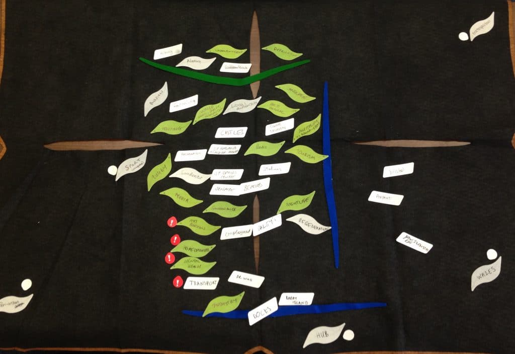
In my case, I asked the participants to draw Cardiff Capital Region, the way they perceive it, and include everything they consider to be part of the region. I chose not to show any official maps or give any information on the different places included because I wanted my guidance/involvement to be minimal. The idea was to compare the results of the three groups with the official administrative boundaries. The participants were informed in advance about the exercise and were also asked for consent in the beginning of the workshop, since I wanted to be able to use the results as a pilot study.
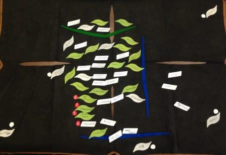
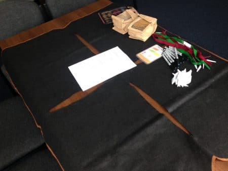
Instead of relying on the classical paper, colourful pens and post-its, I decided to use a toolkit called Ketso. Ketso was designed to facilitate creative engagement and interactive workshops, so for this it provides different materials (for instance large black felts that function as workspace, colourful shapes which can be written on, attached to the felt and eventually washed and reused, small icons, etc.) as well as guidelines. While I used of all the materials, I chose not to follow too closely the guidance and allow the exercise to run more organically.
I had not used participatory mapping or the Ketso toolkit before and did not know what to expect. However, it all worked better than I thought and I was very pleased with the participants’ engag
ement and enthusiasm. Despite having very different knowledge on the topic, they all contributed to the group discussions and many of them said they had a better understanding at the end. As for the maps themselves, results showed a strong emphasis on Cardiff and very different span in terms of the region’s coverage. Since all the participants were academics, discussions tended to be quite critical and various problems, from transport issues to social and environmental ones, were mentioned and analysed.
I am planning to replicate this pilot study with a group of young people soon. Although there are a few details I still need to decide on, I found the seminar very helpful and encouraging, so I am really happy to have stepped out of my comfort zone and run it alone.
[1] National Coordination Centre for Public Engagement, Participatory Mapping, https://www.publicengagement.ac.uk/do-it/techniquesapproaches/participatory-mapping